Hiking the North Section 2 Loop, Central Mountain Range, Taiwan: route planning, permitting & essential gear
Plan your North Section 2 Loop hike in Taiwan's Central Mountain Range. Get route maps, gear lists, and a guide to Taiwan hiking permits for foreigners.
TRAVEL BLOGHIKING BLOGBACKPACKING IN ASIA
How to hike the North Section 2 Loop
Central Mountain Range, Taiwan
(as a foreigner)
This post contains affiliate links. If you make a purchase through them, we may earn a small commission at no extra cost to you. These help cover the costs associated with operating this website. Thanks! Learn more here.
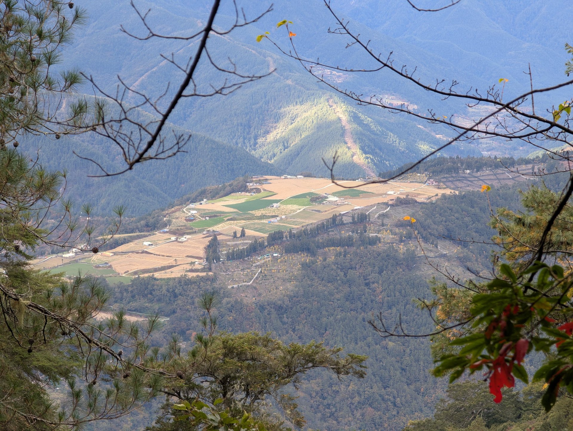
Taiwan is a geographical marvel defined by its dramatic verticality, a result of the ongoing collision between the Philippine Sea Plate and the Eurasian Plate. Despite its relatively small size, the island is home to one of the highest densities of high mountains in the world. The Central Mountain Range (Chungyang Range) serves as the island’s rugged spine, stretching from the north near Su'ao Township in Yilan County to the southern tip at Cape Eluanbi. This range acts as a primary watershed and a formidable weather barrier, frequently intercepting typhoons and moisture-laden winds, which feeds the lush, high-altitude ecosystems that characterize the island's interior.
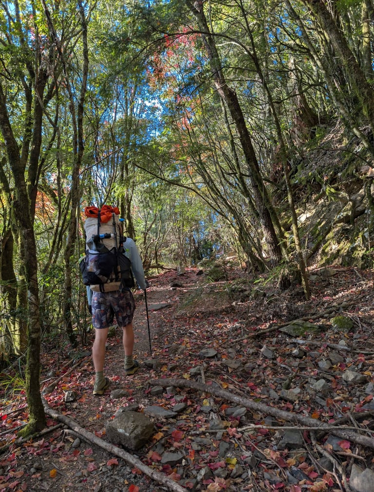
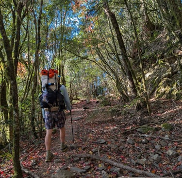
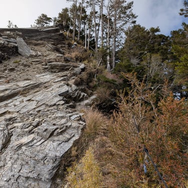
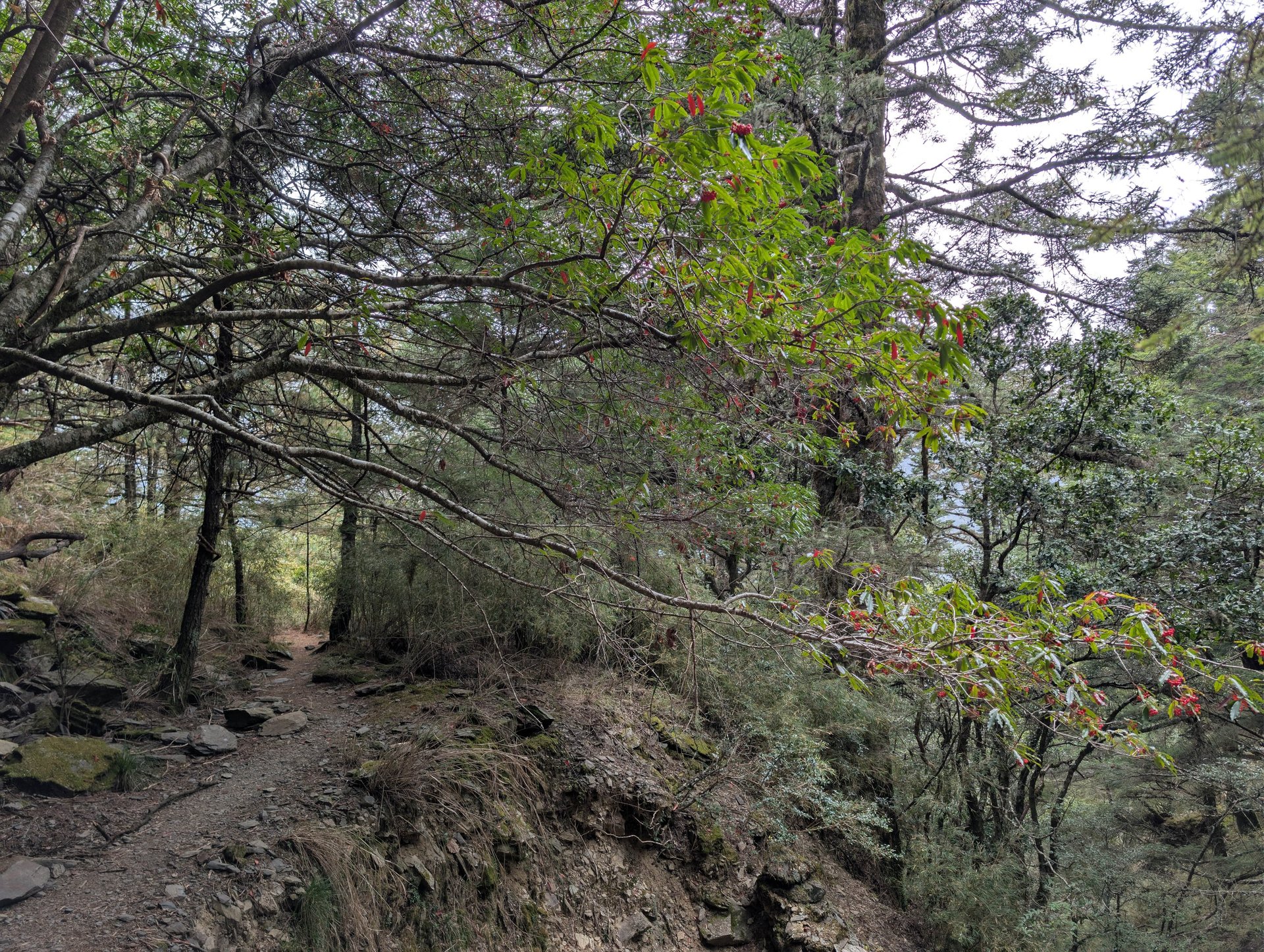
The geography of the Central Mountain Range is notoriously steep and craggy, featuring over a hundred peaks that soar above 3,000 meters. These "Top 100 Peaks" (Baiyue) offer a diverse landscape ranging from subtropical rainforests at their base to alpine tundras and jagged slate ridges at their summits. For adventurers, this means navigating high-consequence terrain—such as the Ghost Gate Cliffs (Guimenguan) or the exposed ridges of Wumingshan—where the tectonic forces have pushed the earth into nearly vertical folding patterns. This isolation has preserved a unique biological sanctuary, making the range a critical habitat for endemic species and a world-class destination for technical backpacking.
Taiwan's Unique Geography and Hiking the Central Mountain Range
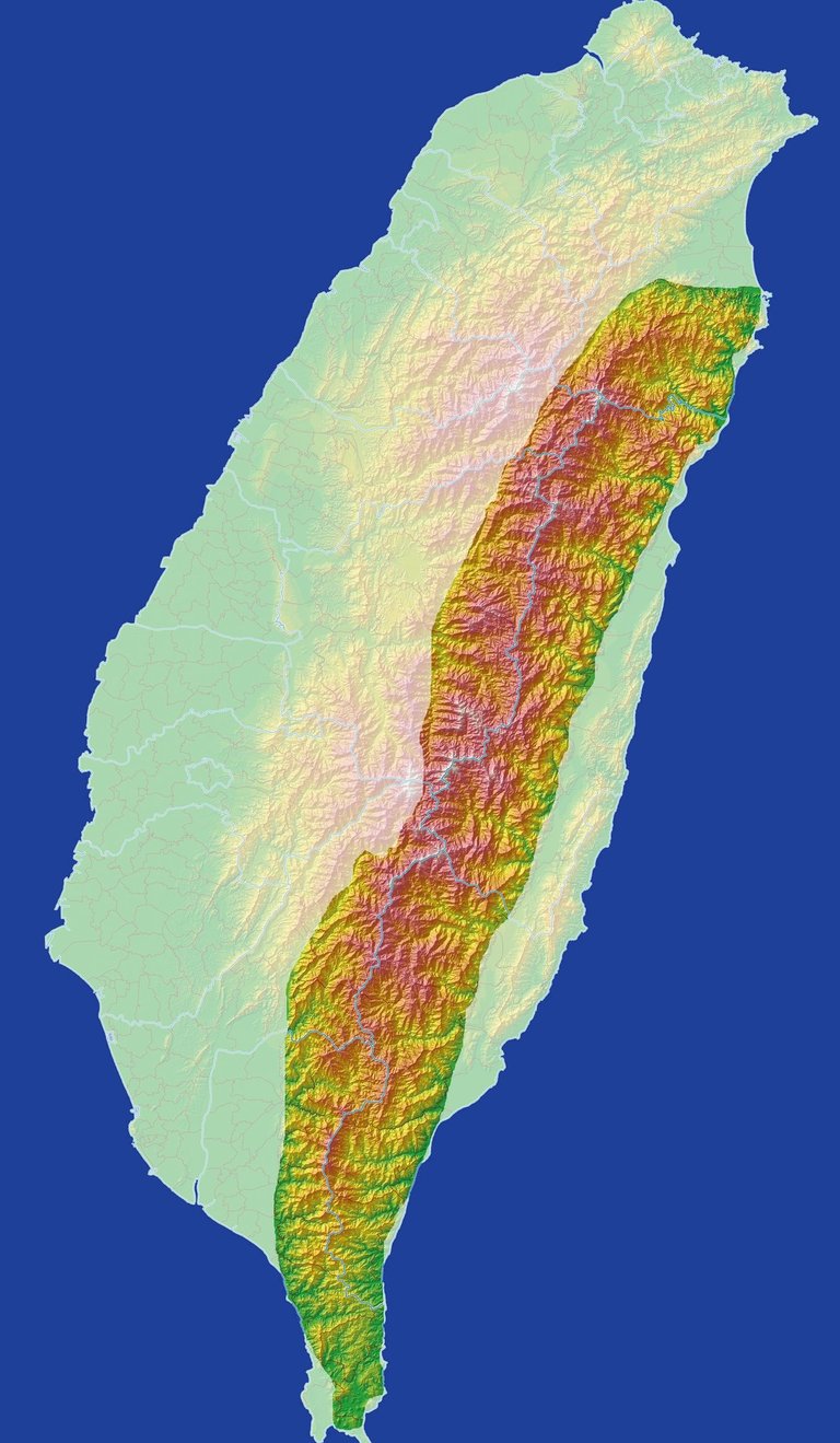
Image credit
Peellden, CC BY-SA 3.0 <https://creativecommons.org/licenses/by-sa/3.0>, via Wikimedia Commons
Choose Your Route
*We're jumping right into the nitty gritty details with this one (skip ahead for the pretty pictures and day by day notes) . we found route planning and navigating the permitting system to be especialy challenging and due the number of requests for this Guide i don't think we're alone. much of the available iformation we found was in chinese and translations were often confusing. U.s. sourced topographical maps are missing essential information for your permit application. we will fill in some the gaps to help streamline this process for future hikers. the central mountain range is an incredibly diverse enviroment with both casual and thrilling adventure backpacking routes. a must see if you love the mountains!
Choose your route (Our route map, as recorded on Gaia). Specifically the campsites you intend to use on your hike as these are how you define your daily route on the National Park Entry Permit, I've included some good maps for reference. Our route was a loop containing the North Section 2 (Ghost Gate Cliffs). We chose to travel the loop in the clockwise direction, it put the most extreme elevation gain in the beginning and left us with a gentle road walk to finish. Some people did warn us that this would add to the difficulty of some of the climbs between Lingmingshan and Wumingshan and I believe they where correct. Nevertheless, I'd make the same choice again. There is a fairly strict quota for this area in the park and our first application was denied due to the zone being at full capacity. Fortunately it was pretty clear our application was in a waiting queue so the denial wasn’t a total surprise, but definitely remain flexible, have multiple dates that will work and avoid weekends if possible. Below are some resources that help with route planning, i.e. maps with relevant campsites and trip reports. Follow this link to begin a permit application. https://hike.taiwan.gov.tw/
a. Here is the Taroko National Park reference page for the route: https://www.taroko.gov.tw/en/trailsAttractions/trail-list/179.
b. Hiking Book App. https://play.google.com/store/search?q=hikingbook+app&c=apps This app, available in the Google Play store with the link, is essentially a Taiwanese AllTrails but with more users posting trip reports for multiday excursions. This was the only place we could find any recent reports about completing our planned route as a loop. (There was a long-standing trail closure due to a landslide and conflicting reports elsewhere about the trail status.
c. Below I’ll provide the exact route we chose as it appeared on the National Park Entry Permit and again in Mandarin so know what the actual communications will look like:
-Please remember this is a technical backpacking route, especially the section between Wumingshan and the saddle east of Lingmingshan. There are many exposed portions -with and without ropes for aid- where a fall would be deadly. Know your abilities, help is far away.-
Day 1 Itinerary (December 15, 2025): Qingquan Bridge → 11.7K Driving End → 17.5K Trailhead
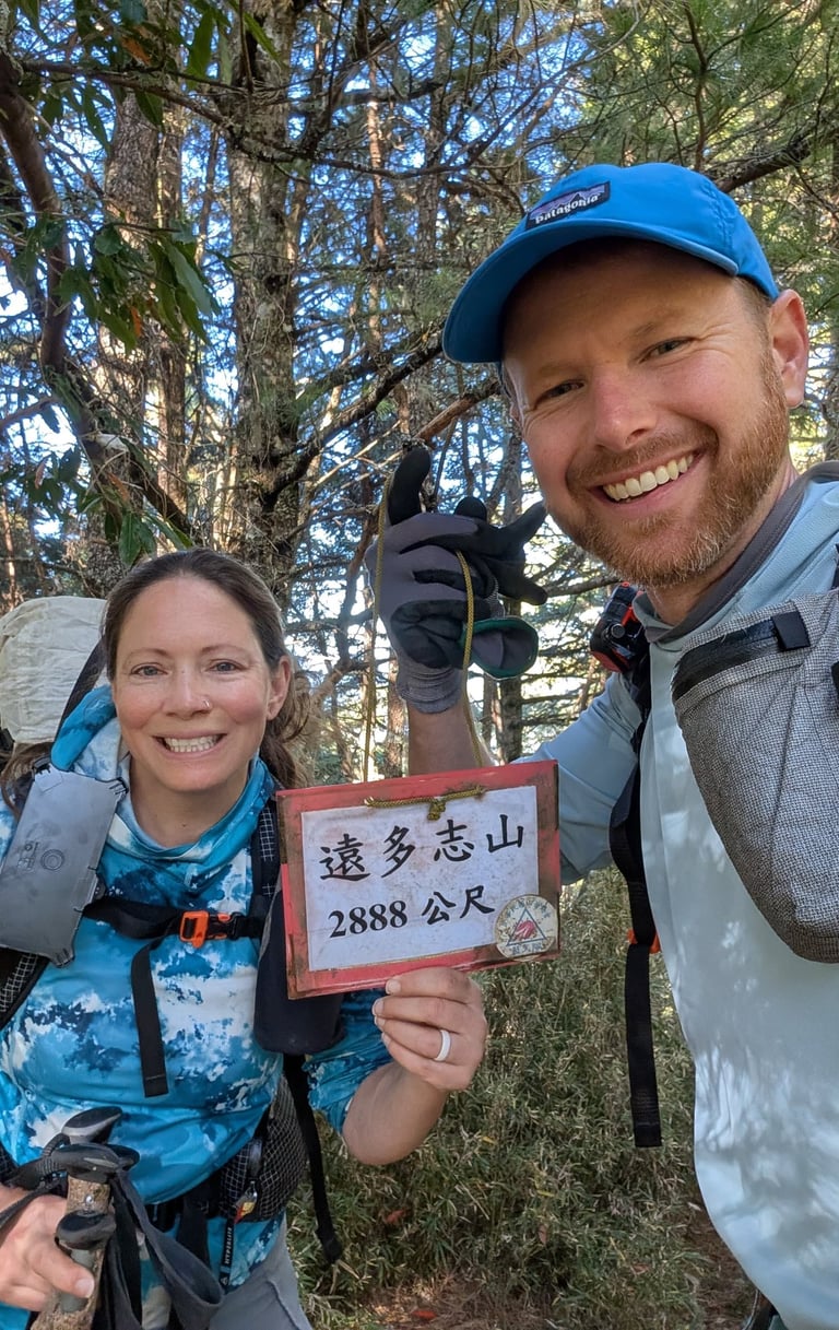
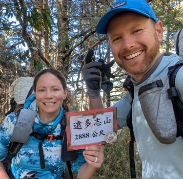
Day 2 Itinerary (December 16, 2025): 17.5K Trailhead → Erwuxi Campsite → Yuanduozhi Mountain → Ganshu South Peak Campsite→ Guimenguan Cliff → Wuming Pool Campsite
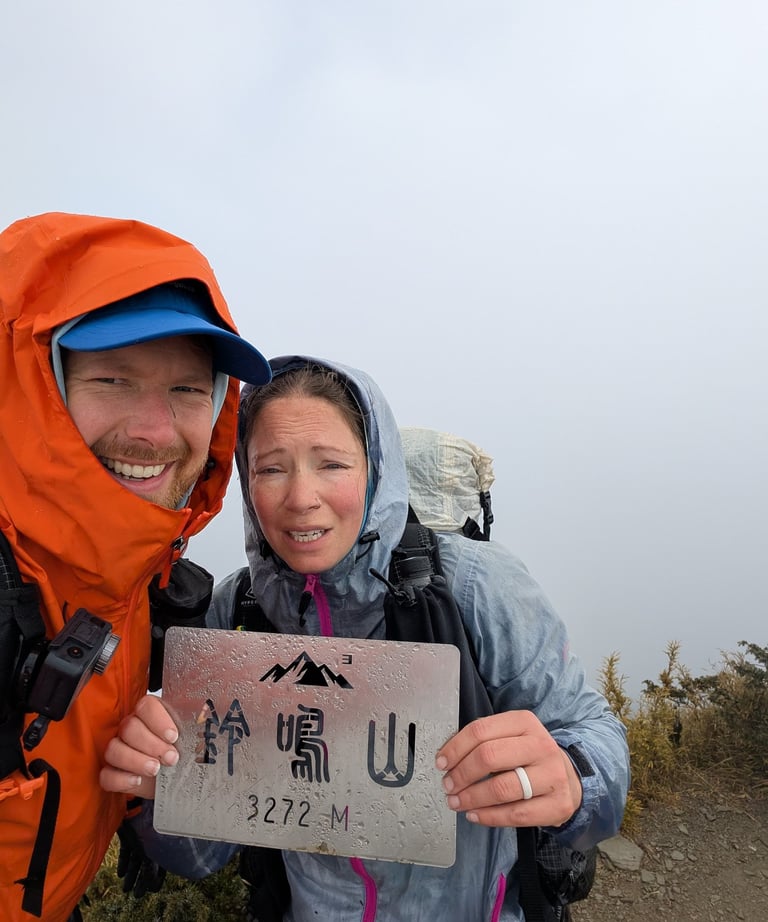
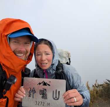
Day 3 Itinerary (December 17, 2025): Wuming Pool Campsite → Wuming Mountain → Wuming West Peak→ Lingming East Saddle Campsite
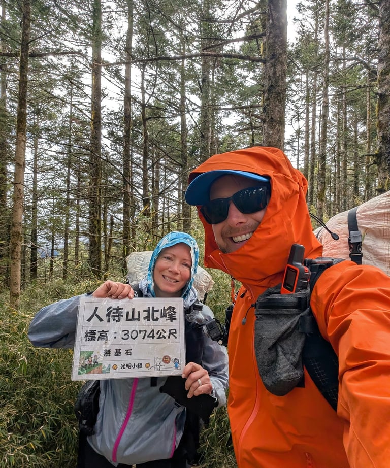
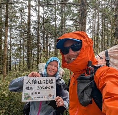
Day 4 Itinerary (December 18, 2025): Lingming East Saddle Campsite → Lingming Mountain → 27K Lingming Mountain Trailhead → 25K Gongliao → 23.2K Shanshan Trailhead → 17.5K Trailhead
Day 5 Itinerary (December 19, 2025): 17.5K Trailhead → 11.7K Driving End → Qingquan Bridge
入園通知
(一)下列為您申請的入園相關資料,本處已審查通過並核准,請您或由領隊入園當日間,上網列印入園許可證(請至『 入園申請 >> 申請進度查詢/入山資料傳送/許可證列印』列印,網址:https://hike.taiwan.gov.tw/)。
您申請 2025-12-15 前往主路線: 【 北二段(鬼門關斷崖) 】 次路線: 【 北二段(鬼門關斷崖) 】
行程日期 路線規劃
第1天行程(2025-12-15)清泉橋→11.7K車行終點→17.5K登山口
第2天行程(2025-12-16)17.5K登山口→耳無溪營地→遠多志山→甘薯南峰營地→甘薯南峰營地→鬼門關斷崖→無明水池營地
第3天行程(2025-12-17)無明水池營地→無明山→無明西峰→鈴鳴東鞍營地
第4天行程(2025-12-18)鈴鳴東鞍營地→鈴鳴山→27K鈴鳴山登山口→25K工寮→23.2K閂山登山口→17.5K登山口
第5天行程(2025-12-19)17.5K登山口→11.7K車行終點→清泉橋
The original permit as sent by the park service in Chinese.
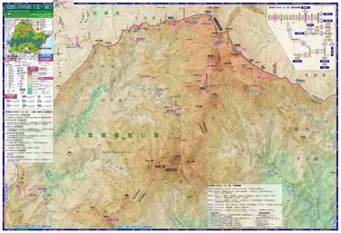
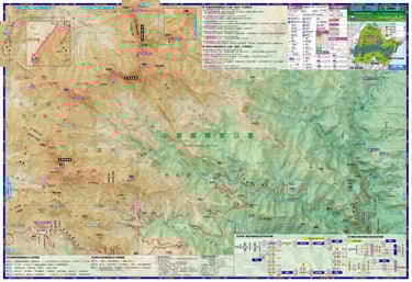
Official Taroko National Park Maps
Here are the two maps we used to plan our route. They contain the names of the campsites and other reference points used to fill out your permit. (some translation still required)
-click on the links for full size high resolution map downloads
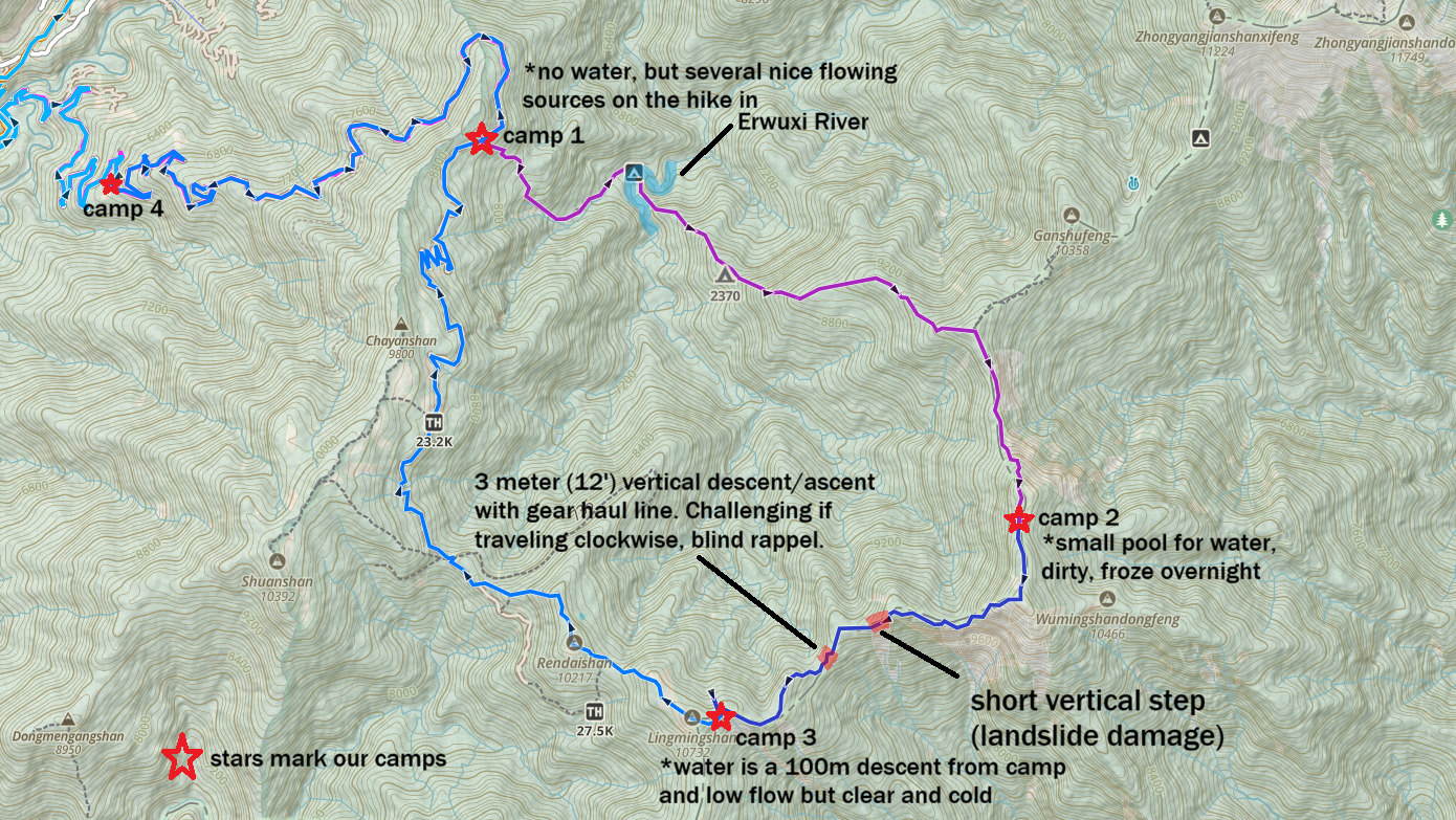
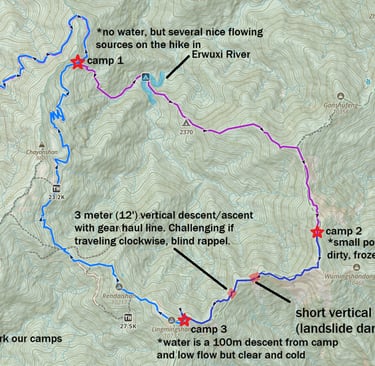
-Map of our hike, with the two most challenging sections (in our opinion) marked. There where at least a dozen other sections with exposure and/or ropes to aid in climbing.
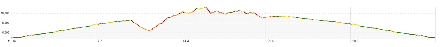
Above is an elevation profile of the route traveling in the clockwise direction. The first several thousand feet can be avoided by driving to the trailhead.
Submit your National Park Entry Permit application here https://hike.taiwan.gov.tw/. There is an option for English in the upper right corner of the homepage, at least on the desktop version of the site. Have your passports available and applications open 30 days before the date of intended entry for most areas.
The North Section 2 does not require a police issued Mountain Entry Permit, sometimes called a Mountain Access Permit, this part of the permitting is rather difficult to understand and I believe some of the more subtle details are lost in translation. Taroko National Park’s website confirmed that the Mountain Entry Permit was not needed for this route but out of an abundance of caution we applied anyway and it was denied.
Now on to the fun part, paperwork done, gear packed… Not quite, let’s run through some essential equipment for this hike. Mountain weather here can be severe and unpredictable. On our five day trip we encountered balmy warm temps at lower elevations, cold soaking rain on mountain ridges, and below freezing temps overnight at camp.
Clothing- Pack light but smart. For our December hike we brought (and used):
Durable gloves suitable for climbing and descending hundreds of meters of fixed ropes. ESSENTIAL! (we used mechanics/gardening type gloves)
light leggings
rain shell pants
lightweight down jackets
shorts (we’re both diehard shorts hikers)
light merino wool beanie (for Moose only, Bug's hair keeps her warm!)
Satellite Communication Device. We use a Garmin InReach, and it worked well for the nightly check-in messages we sent and it gives you a little security in case something goes really wrong. It’s also strongly recommended by the park and we provided them with our InReach info on our application.
Water Filter- We brought both a Sawyer Squeeze filter and our Katadyn Steripen UV filter. We were grateful to have both on this trip as only water source on the ridge (a small stagnant pool) had a concerning amount of trash around it.
Your regular backpacking kit. I’m assuming if you’re attempting this route you have the rest of your gear dialed in. If not, this might not be the best hike for you. But don't be discouraged there was a time before Moose and Bugs knew how to set up a tent too! For more of the gear we love and use on our adventures check out our gear review section.
Submit your Permit Application & gather Essential Gear
Map locating Lishan Red Bridge (Qingquan Bridge)
I've included a map below that shows the location of Lishan Red Bridge or Qingquan Bridge (the "q" character in pinyin sounds similar to an aspirated "ch" sound in English, as in chi or cheese), the latter is the name the bus will use for the stop. This would be where you deboard the bus and it is the starting point of the road that leads east up to the marked trailhead, 11.7km up the road.
Navigate to the Trailhead: Bus, Train or Automobile
5. Get to the trailhead. Some might say we opted for the hardest way to get there, I’ll break it down below... Our starting point was Hualien, so adjust directions as necessary.
Train from Hualien to Yilan. About 60 minutes. We bought all our train tickets in Taiwan using the Taiwan Railway e-booking mobile app (https://play.google.com/store/apps/details?id=tw.gov.tra.twtraffic). It has abysmal ratings but it functioned fine for us.
Bus 1751. About 3 hours to Lishan Red Bridge (Qingquan Bridge 清泉紅橋山莊). The bus is located right outside of the train station in Yilan. This is a slow and winding bus journey with one bathroom stop in Nanshan Village. There are some nice scenic views on the way though. A more popular option is to take the bus the day before you plan to hike and stay at a hostel or hotel in Lishan or Huanshan Village and use a shuttle service to reach the trailhead. Or rent a car, but keep in mind the last few kilometers of the road is dirt and can be muddy with substantial ruts.
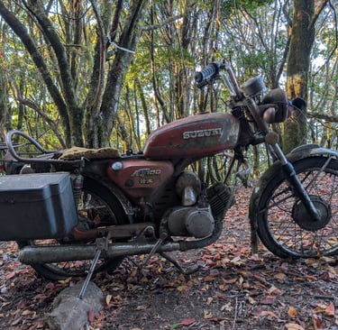
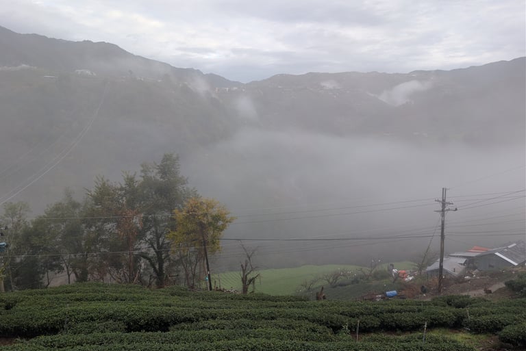
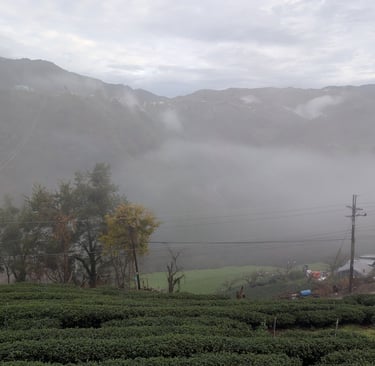
Walk to the trailhead. From the highway it’s over 7 miles (11.7km) and 2700ft (820m) of elevation gain to the last vehicle accessible trailhead. We really enjoyed the walk up the road, there were really interesting tea fields, fruit orchards and monkeys!
Hike!! Next we’ll share some day by day notes on the route. (stats from our Gaia GPS recordings) All credit goes to Samantha (aka Bugs) for keeping these daily notes!
We know this extreme style of backpacking isn't for everyone. I'm not sure a lot of people would even consider it a vacation, but don't worry there's something for everyone in Taiwan! We're proud to share some tours you can book in Taiwan through our new partner Viator. They make sure all the tour operators on their site meet their standards and they have a huge range of offerings; from day hikes in Taroko National Park to private food tours in Taipei. Since Viator is owned by TripAdvisor, you can book with confidence knowing that the experiences are backed by the same massive community of authentic traveler reviews and rigorous quality standards they already rely on for their research.
Going to Taiwan but not sure backpacking is for you.
Try these experiences through our partner Viator!
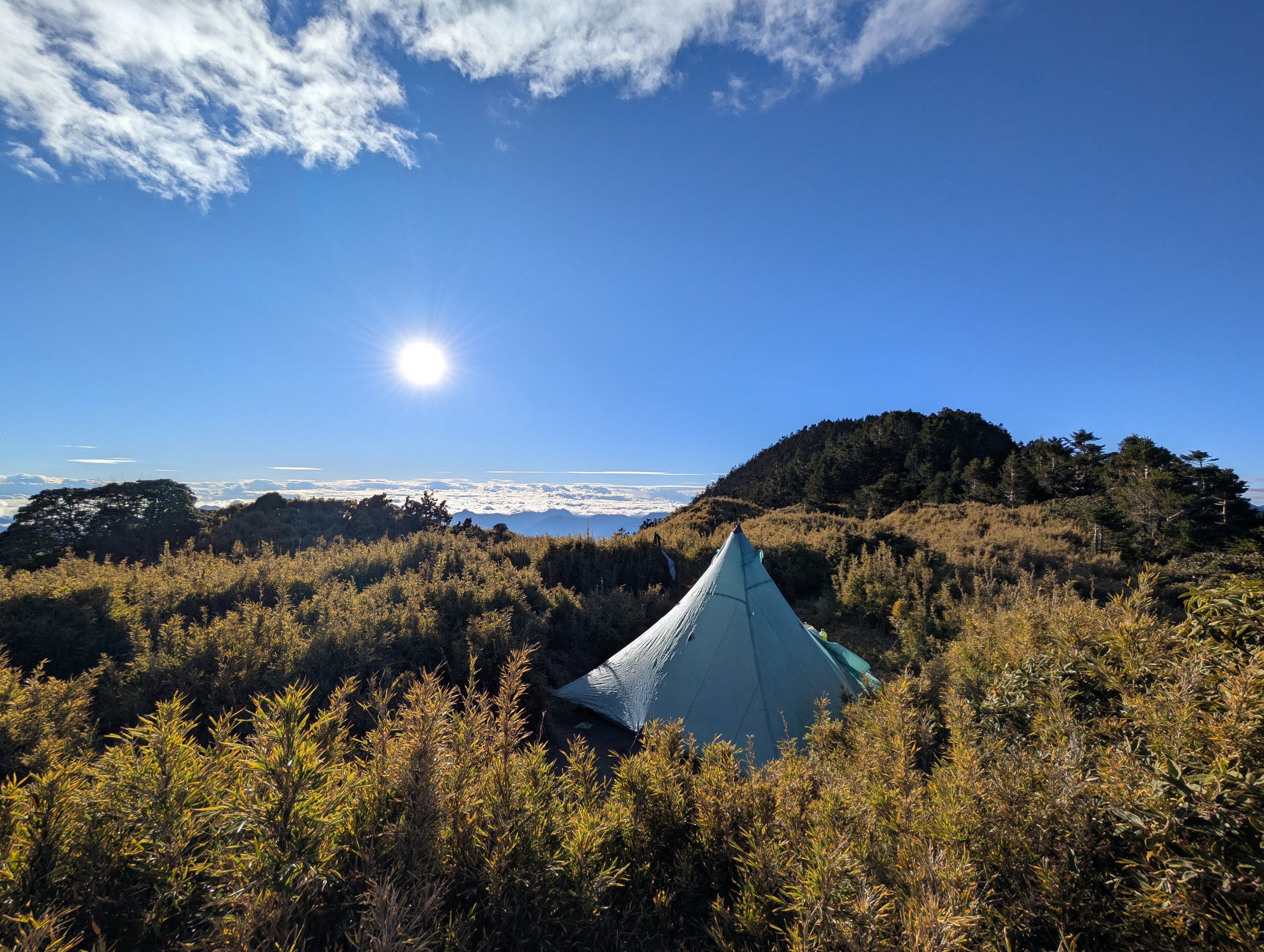
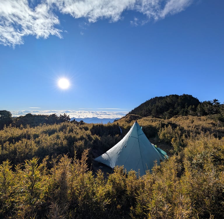
Day 1- Good Vibes.
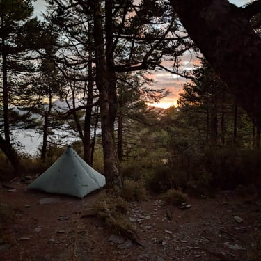
Day 1: 10.42 miles 3632’(-10’) We started around 11:00 am with a beautiful road walk followed by a few miles of nice trail that was washed out in a few short sections. We camped at 17.5km camp, though it's really just the junction of abandonded forest road 730 and the trail to the Erwuxi River, our route for tomorrow. Not a popular campsite.
Daily Hiking Notes: North Section 2, Taroko National Park, Central Mountain Range, Taiwan
Day 2- Things get interesting.
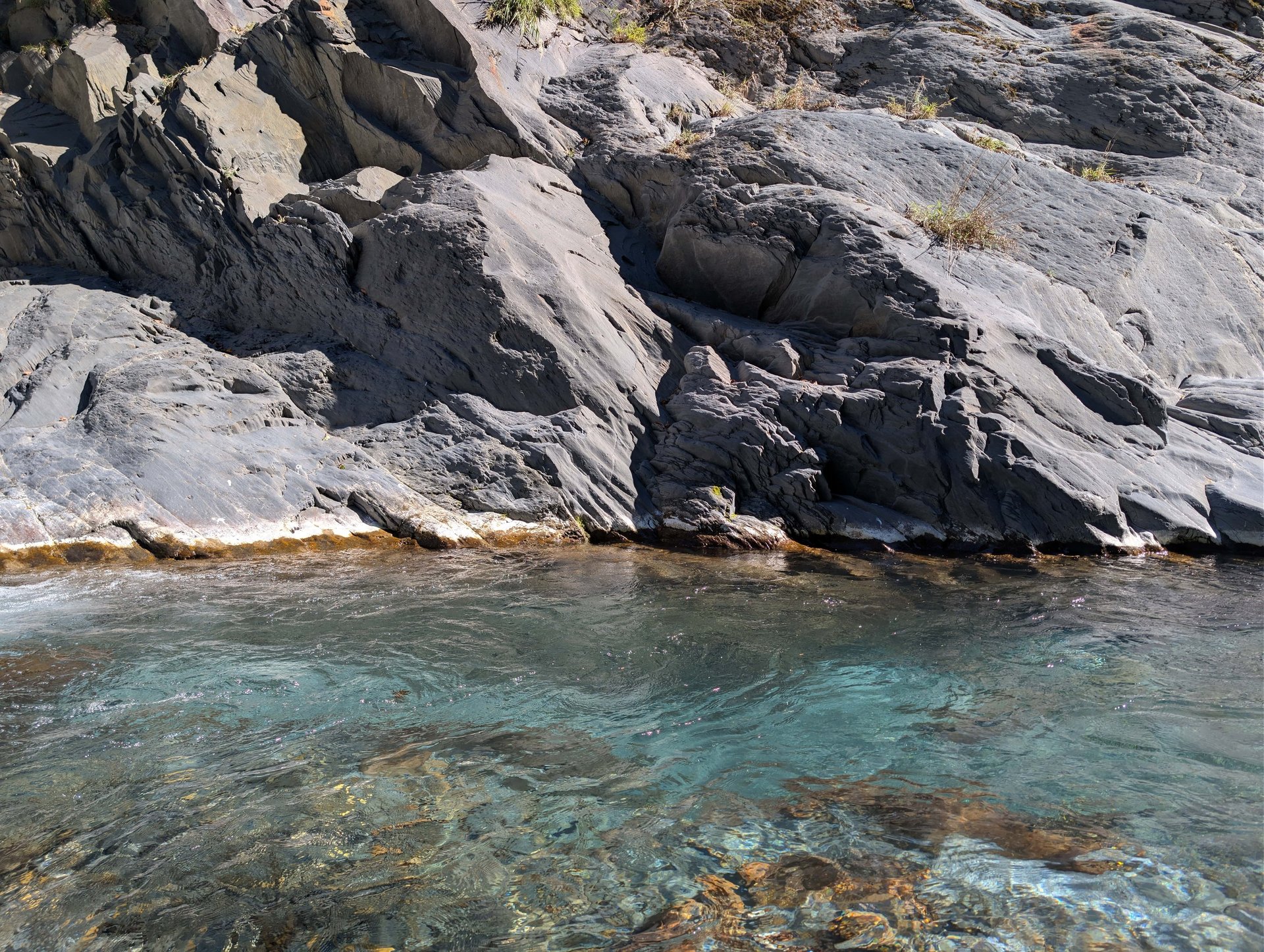
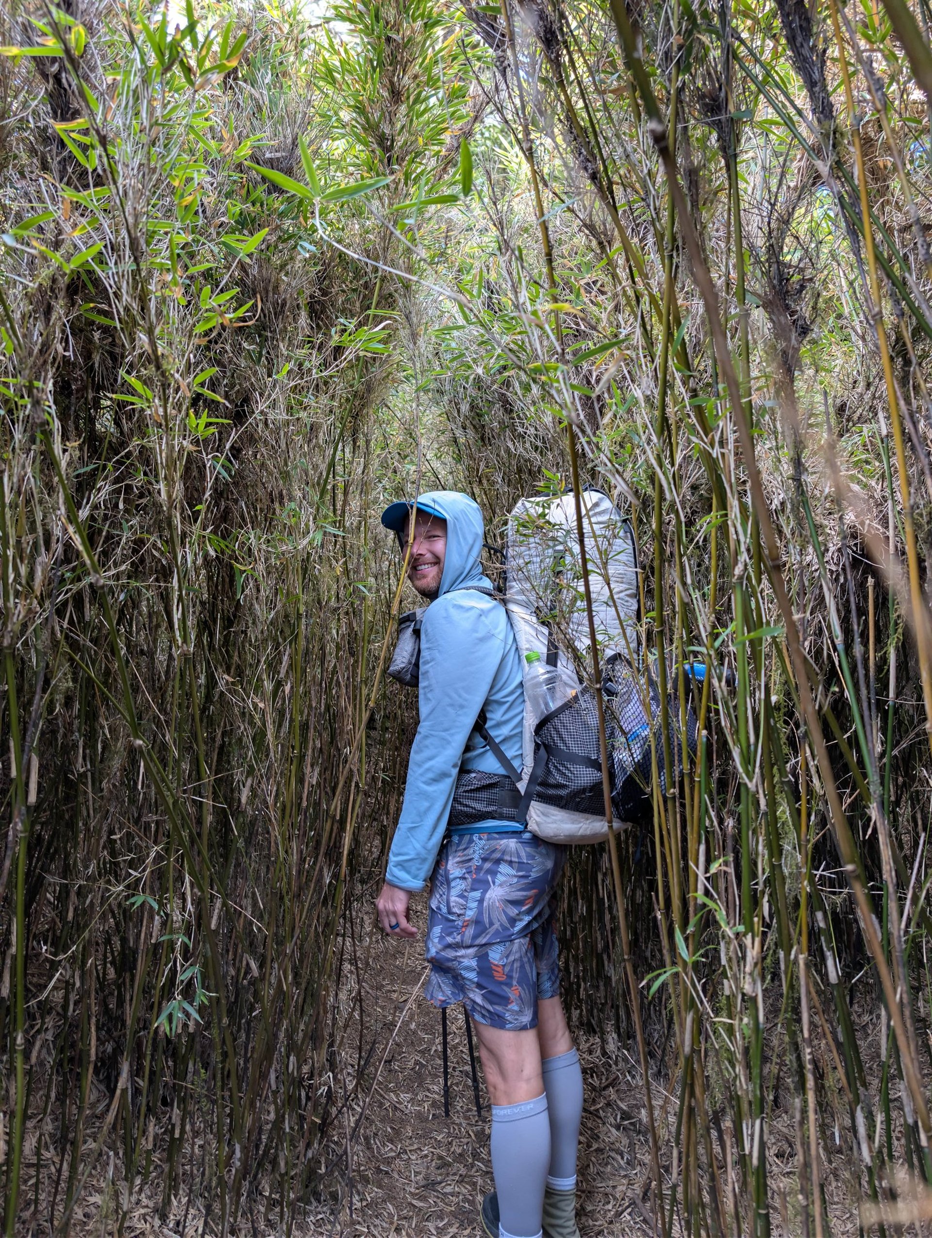
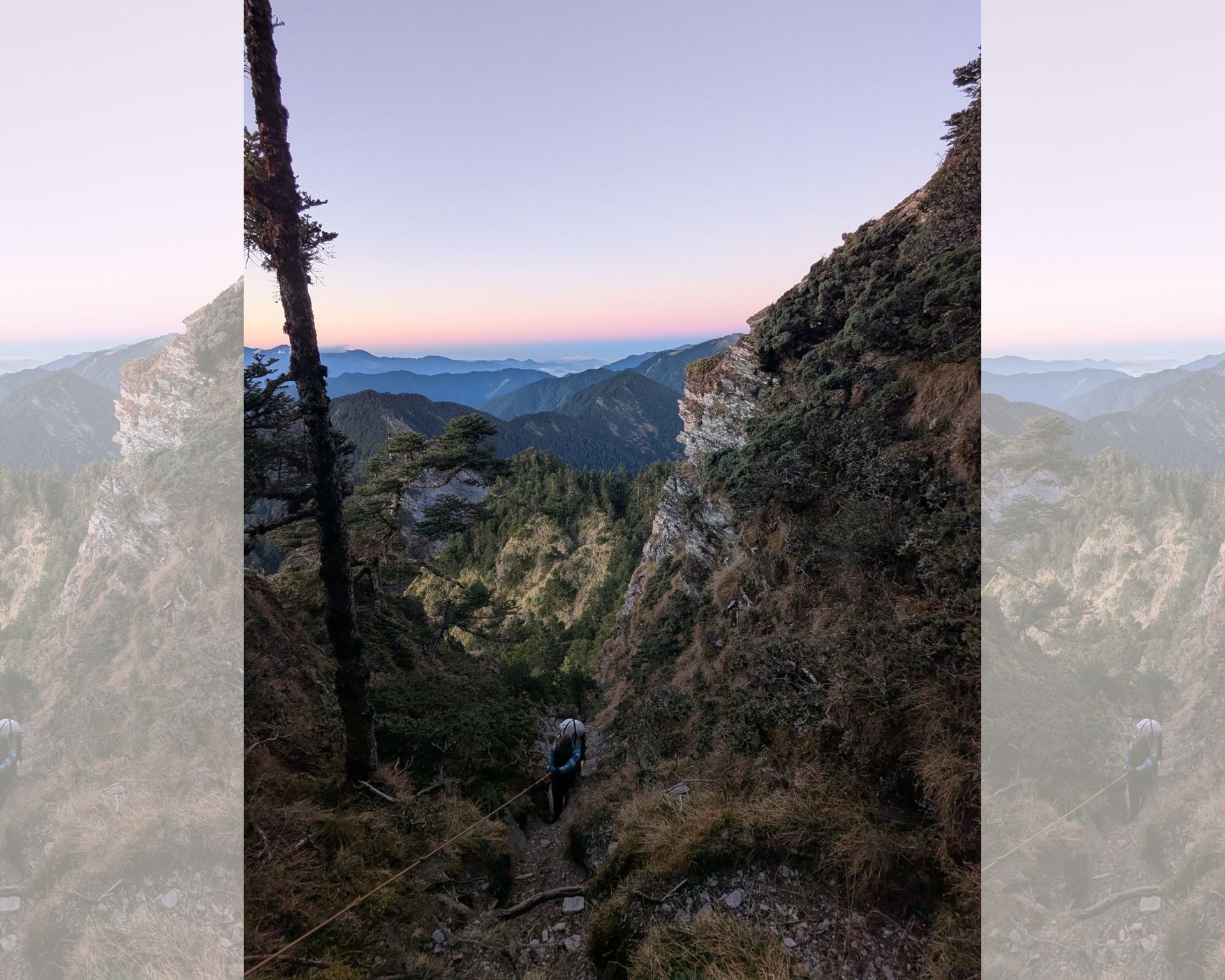
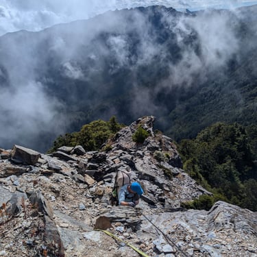
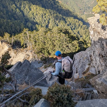
Day 2: 5.92 miles 4,929’(-2,566’) We didn't start hiking until about 8:30am. In hindsight I would have started a few hours earlier, but we made it. The day started with a few thousand feet of descent to the Erwuxi River. There was a nice trail with lots of ropes to assist when it was steep. We stopped at the river for 90 minutes to soak in the sun. The Erwuxi River was a beautiful sapphire blue! The next section of trail to Sweet Potato South camp (Ganshunanfeng Camp) was pretty nice with good tread. We originally planned our route with a camp here, but we changed it just before we submitted our itinerary. It definitely would have made the day easier, but the camp was small and there was a surprising amount of trash and toilet paper... The next section is where things got crazy. Though there was still a good foot path and plenty of ropes, it was slow going. Most of the trail was overgrown with bamboo which isn't that bad to walk though, but it definitely slows you down! Then the climb at the end of the day was pretty exposed and vertical, but with an amazing rope system! This was the infamous Ghost Gate Cliffs (Guimenguan) we had heard about. We made the summit of 11,070 feet right at sunset (which is why we should have started a few hours earlier). The view was amazing! We hiked to the pond and set up camp with a headlamp, but it was easy terrain. The water (Wuming Pool we think) was pretty bad, with trash in it and it kind of smelled. We ran it through our filter and then used a Katadyn Steripen just to be safe.
Day 3- Things get really interesting.
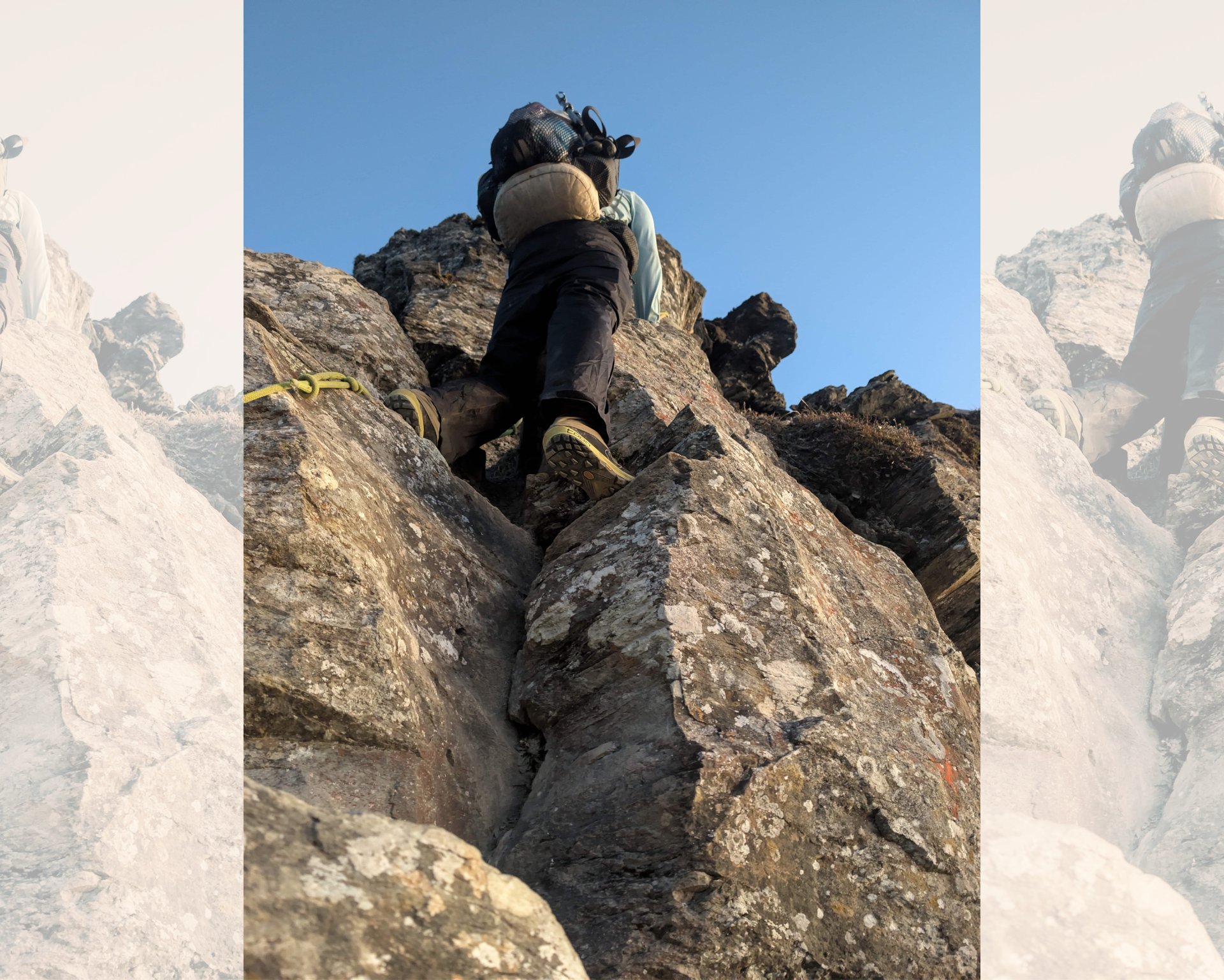
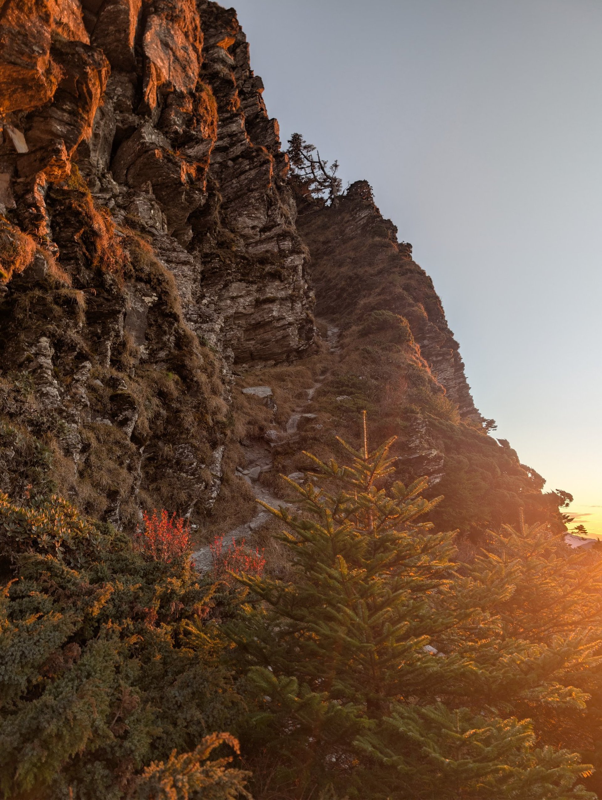
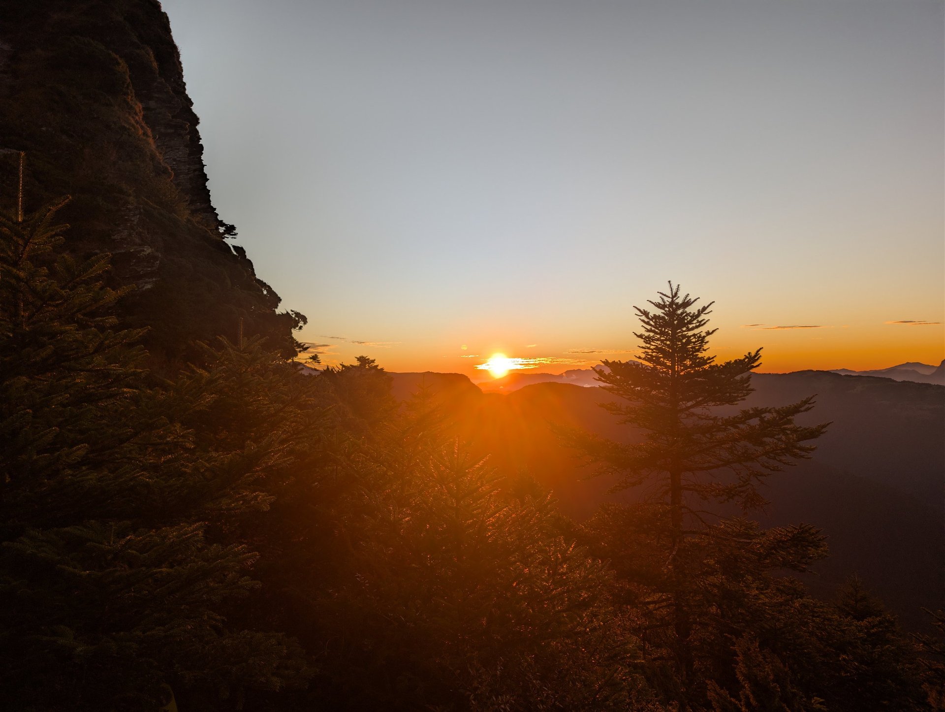
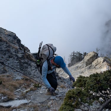
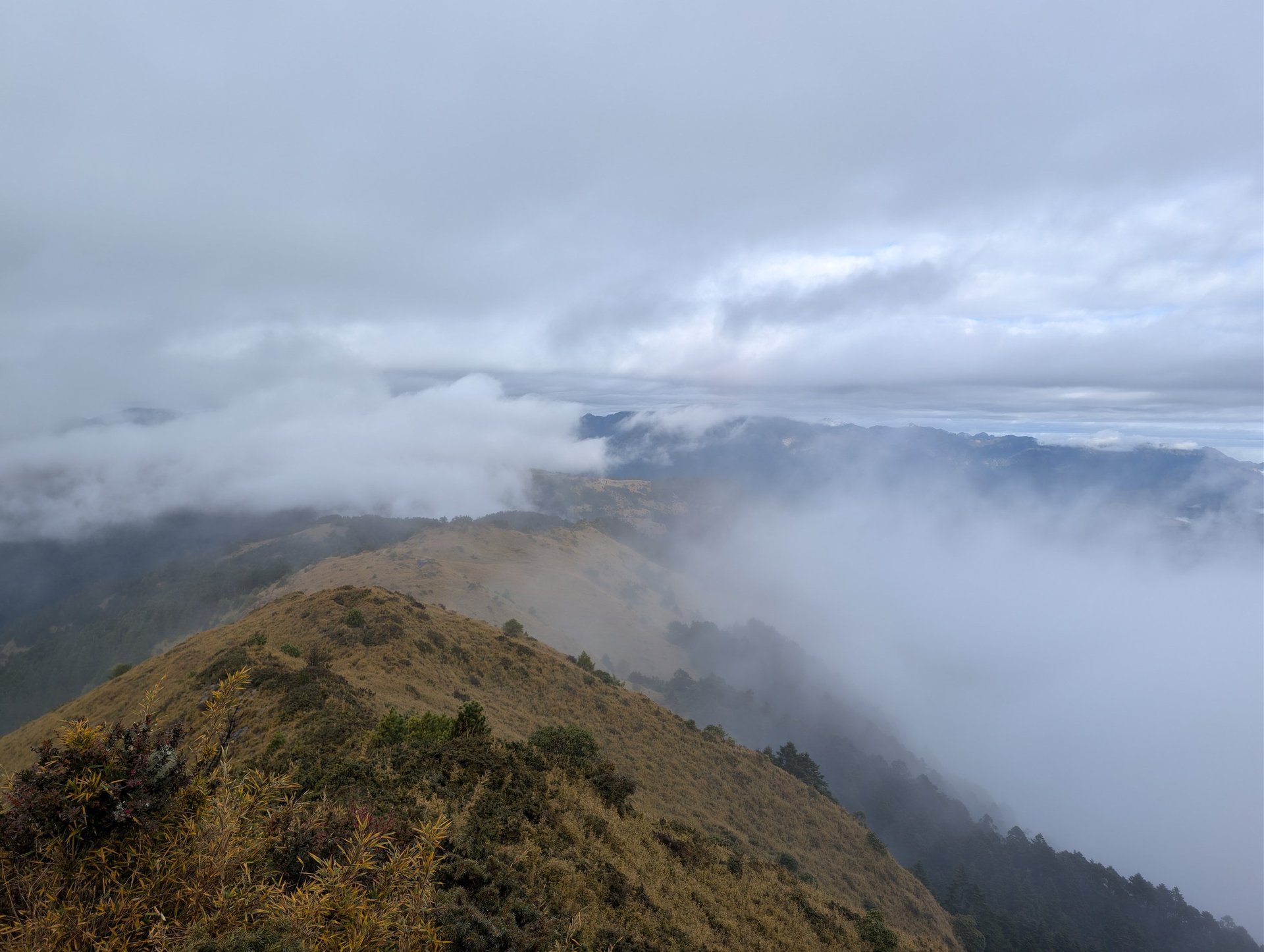
Day 3: 3.53 miles 1,684’(-2,407’) We started around 8:30 am and got to camp around 4pm not including our climb to and from the water source at the East Saddle of Lingming Camp, almost half a mile roundtrip with 400 feet of descent and then ascent. This day was hard and slow! There are a lot of ropes, but also many high consequence no-fall zones. The first part of the day from Wuming Pond to Wuming West took us 4 hours which is an hour longer than the park listed (their maps include time estimates between certain points, I imagine this estimate was pre-landslide). This section was the hardest trail I've ever hiked. Much of the route is exposed and a fall could be deadly. The ropes helped a ton and some parts couldn't be done without them. After a false summit before Wuming West there is a 90° down climb that is about 12 feet tall. A trail report from HikingBook had alerted us to this section rather cryptically, I quote, “that separates package from man”, this was after translation from Mandarin of course, but this must have been it. Thankfully, like in the description there was a gear haul line so you could lower your pack first and then rappel down yourself. There were also several exposed ridge walks and many cliffside traverses on almost vertical forested slopes. And to further complicate things a thick fog had rolled in, greatly reducing visability and making it damp and chilly. My nerves were completely shot by the end of this. The second part from Wuming West to the East Saddle of Lingming took us 3.5 hours, which is less than the park said, but it is still a challenging section, just less technical climbing. But there are a few down climbs with ropes and a few exposed ridge walks so you’ll still need to be on your game. The climb down to the water source at the East Saddle of Lingming just added insult to injury,😂 but the water was nice and cold and we made it back to the tent just as the sun set. Unfortunately this camp site too had a lot of trash and human waste so we used our Steripen again just in case. It was stormy and rained all night.
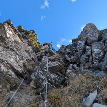
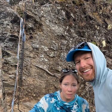
The ropes that "seperate package from man". Longest 90 degree climb on the loop.
Day 4- Sometimes it rains.
Day 4: 13.4 470’(-4,589’) Terrible trail leaving camp, very overgrown and it didn’t help that we were completely soaked. Very thick brush and undergrowth, compounded by the cold rain this was a tough morning. The trail improved once we hit the summit of Lingming and so did the weather. After a few miles of trail winding through bamboo and forests we hit abandoned logging road #730 and it was great. We camped on a small deserted pullout about 4 miles from Red Bridge and 3 miles down the road from the trailhead.
Remember mountain weather can be both fickle and severe. The weather this day oscillated between a soaking cold rain and calm clouds ending peacefully and partly sunny.

Day 5- The way home.
Day 5: About 4 miles and -1500’ to the bus stop down the road, I lost the actual track for that day. It was only a couple miles of road walking and we caught a bus from Lishan at Qingquan Bridge at about 9:00am. From here we reversed the directions (with a short stop in Yilan to eat some stirfried duck) until we finally made it back to Hualien. We even walked the last two miles back to our apartment after the final train ride just for kicks.
Final Thoughts
This was an excellent route for the experienced and adventurous backpacker. An out and back route could be done to either Wuming or Lingming and eliminate the most challenging and high-risk segments and still be a rewarding trek but I found completing the loop to be deeply satisfying. In addition to the amazing views and exciting climbing there was a large amount of wildlife including native pheasants, muntjacs and other small animals!
A small footnote I feel I must make: There was an inordinate amount of trash and poorly concealed human waste, even near some of the remote water sources on the ridge, critical for both the endemic animals and hikers. This came as a surprise considering the strict quotas on the area and the fact we saw a grand total of 2 people in 5 days. I'm not placing blame on anyone as I don't know who is responsible, all I can do is encourage future hikers to practice Leave No Trace principals. Follow this link to the lnt.org website if you need any tips or a better understanding of what "leave no trace" hiking entails. Help us preserve these amazing places for everyone, not just us hikers, but the animals that live there too. Thanks and Happy Trails!
-Moose (Don)
Thank you for taking the time to read our blog, your continued support means the world to us! If you haven't already, please sign up for emails so you can stay up to date. And remember, step out of your comfort zone when you travel; try new foods, stay in traditional accommodations, try and speak the native language, even a few phrases is appreciated, talk with strangers, accept invites into their homes, and leave the tourist districts whenever possible. If you're not embracing their culture and their way of life you're missing the most rewarding experiences traveling has to offer!
Meet the Author
Hello, I'm Don, a.k.a. Moose. I have a penchant for history, especially ancient Greece and Amir Timur's rule in Central Asia. I'm also an adventurous eater with a love for global street food (naem/แหนม, anyone? Thai-style raw fermented pork is a personal favorite).
But my true passion is rugged, long-distance hiking. The more remote the location and unknown the route, the happier I am. You'll find me most at home wandering the deserts of the American Southwest, or the fringes of Amenia along the Iranian border, or traversing a steep snowfield in the Washington Cascades.
I hope I can share my love for adventure with you.
Thanks to All our Supporters!
Brandon (Exxon)
Ann M.
Jennifer McDonald
Jonel Wachtman
Akash Mondal
Robin & Kevin Tice
Gail & Greg McCarty
Erin Bergen
Clair Blume
Kent Rewis
Andrew & Justine Knox
Seth Yoder
Cheryl & Hap Reeves
Robert Kooken
Linda Koening-Warren
Janet McCarty
Diane & Lowell Richardson
Ann Slagle
Stephanie Bender
Kay Massong
Enjoy our content?
Show your support and donate here. Unfortunately life isn't free, content creation takes time, and we need to be fed frequently.
Thanks! Moose and Bugs